We arrived in Israel on March 31 and starting late the next day began to get ready for Passover, cleaning leaven out of Beth's apartment, buying food, etc. I wasted a fair amount of time searching Bnai Brak for deli meat (all they seemed to have at butcher shops and groceries there was fresh and frozen meat) but just outside of Bnai Brak (the image show the boundary with the flags being Ramat Gan and the buildings in Bnai Brak), I found a grocery (about where that image was taken) that had deli (we were not going to be able to cook because there wasn't time to kasher the stuff in the apartment for Passover).
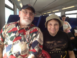
 On April 3 we checked into an apartment in Tel Aviv that was offered by Airbnb. It was near the Opera Hotel (in the background of the second image). We chose this place because it was walking distance to where we were going to have our seder.
 The seder was quite a long one. We didn't get to the main course until after midnight and got to the afikomen a few minutes before 1:00am. As it turned out, Ann hurt her foot coming home from the seder. The image shows the foot a week or so later after it had been injured again. Ultimately this restricted our activities somewhat and Ann saw a doctor and got an x-ray (no fracture) in Tel Aviv on April 12.
These images show the pedestrian mall that runs roughly between Bialik Street and Hertzl Street from Rambam square to near Jabotinsky Street.
 The first image shows the mall in the daytime. The toy cars on the right and the kids on the left mean that the boulevard lives up to its name.
The second is from an early evening during the time we were there.
The first image shows the mall in the daytime. The toy cars on the right and the kids on the left mean that the boulevard lives up to its name.
The second is from an early evening during the time we were there.

 The third shows the same place a week after we left (taken by Beth).
The city changed the color of the lights and put an Israeli flag there
Presumably this was for Independence Day which was a week or so after we left Israel.
The third shows the same place a week after we left (taken by Beth).
The city changed the color of the lights and put an Israeli flag there
Presumably this was for Independence Day which was a week or so after we left Israel.
Numerous high rise buildings are going up in Ramat Gan, Tel Aviv and even Bnai Brak.
The first image is a building on Jabotinsky Road in Ramat Gan (Ramat Gan means 'Garden City) but the building is only a few blocks from Bnai Brak. The lack of furniture on the balconies probably means that people haven't moved in yet. The poster on the left is an advertisement for membership in a golf club (I think). There are two flags on the pole. The one on the left is the Ramat Gan flag, the one on the right is the Israel flag.
The second image is of a thirty story residential building just across the street from where Beth lives. In the foreground is Rambam square.
 As we've been visiting Beth the past few years, the building has gotten closer and closer to being occupied but I think (again based on the balcony rule) that it is not quite to the occupancy level.
 The final image is taken from Rabbi Akiva street in Bnai Brak. This is the main street of Bnai Brak. You can see the old 1950s type construction on the left.
A more modern 1990s building containing retail is on the right (it has arches on the street level). However, in the background is a new residential tower a few blocks away. I think it is also in Bnai Brak but not in the 'Haredi' part.
The final image is taken from Rabbi Akiva street in Bnai Brak. This is the main street of Bnai Brak. You can see the old 1950s type construction on the left.
A more modern 1990s building containing retail is on the right (it has arches on the street level). However, in the background is a new residential tower a few blocks away. I think it is also in Bnai Brak but not in the 'Haredi' part..
Gan HaMelech David (Garden of the King David)) is at one entrance to the Children's boulevard. In a sense it is a continuation of the Children's boulevard.
 It's probably no more than an acre or two but mostly linear and about 25%-50% paved pathways.
There are trees and grassy areas (one of the latter is a dog park).
It's probably no more than an acre or two but mostly linear and about 25%-50% paved pathways.
There are trees and grassy areas (one of the latter is a dog park).
 But it is all squeezed together between three intensely retailed streets (Jabotinsky, Hertzl and Bialik).
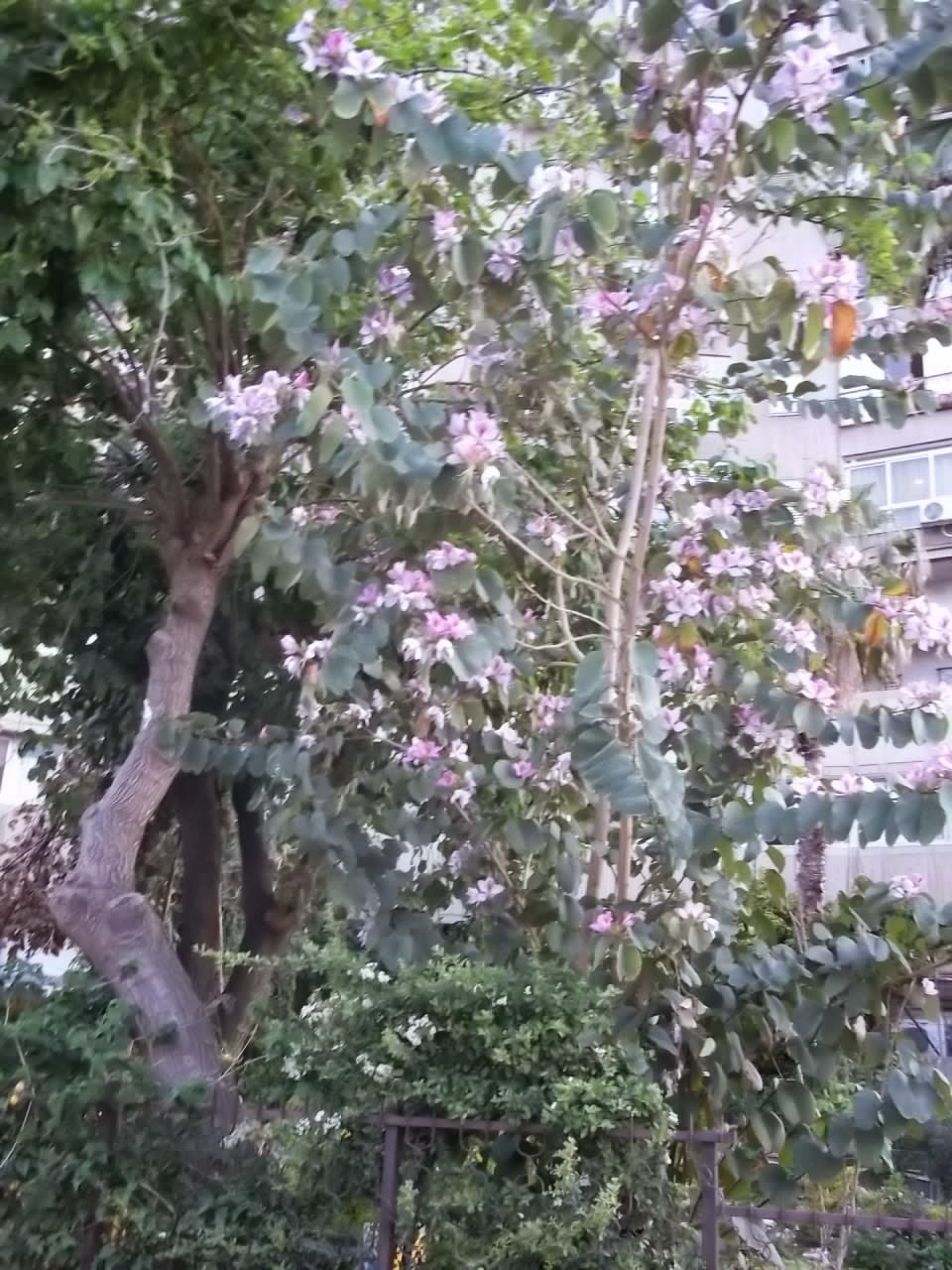
Images 1 and 3 are different entrances. Image two is a tree in bloom.
But it is all squeezed together between three intensely retailed streets (Jabotinsky, Hertzl and Bialik).
Images 1 and 3 are different entrances. Image two is a tree in bloom.
B'nai Brak is next to Ramat Gan. It is the 'hometown of Haredim' in Israel. Thus rabbis are heros and people put pictures of rabbis in their home. Hence an art store that sells such pictures is the first image. Modern day Bnai Brak is the poorest and most densely populated municipality in Israel.
 Unlike other Haredi communities, the religious fervor expresses itself in ways that are not particularly off putting to secular or non Jews. For example, the sign on the building under construction on Jabotinsky street a few blocks from Rabbi Akiva street says, "Evil Speech: Don't Speak it Here". Also, when you walk through the town you see plenty of non Haredi people, some dressed in shorts. I boarded the intercity bus to Jerusalem in Bnai Brak and, while women and men generally clustered in different places on the bus, one couple (man and wife I presume) sat together and a number of younger men with no head covering were scattered throughout the bus.
 The sign in the image which is at the border between Ramat Gan and Bnai Brak says, "Bnai Brak in big letters and in smaller cursive letters says, "Blessed are your comings in" which (as my brother Irwin pointed out are the first three words of Deuteronomy 28:6). This seems to be a friendly invitation to all, religious and secular although in the context of that sentence in Deuteronomy, it might mean to apply only to people (or a society) who obey the law. This is because curses for societal transgression follows that verse.
Bnai Brak is mentioned in the Bible (Joshua 19:45) as a Canaanite village. It probably meant, 'children of ibrak' or something similar. B'nai Brak also is mentioned in the Passover Hagaddah where scholars, at a seder in Bnai Brak, are retelling the story of the Exodus intently and have to reminded that it is morning and time to pray. Bnai Brak also appears in a surprising sentence in the Talmud that says that the descendants of Haman (presumably a daughter or grand daughter of Haman converted to Judaism) taught in Bnai Brak (tractate Gitten folio page 57b in the Babylonian Talmud).
The sign in the image which is at the border between Ramat Gan and Bnai Brak says, "Bnai Brak in big letters and in smaller cursive letters says, "Blessed are your comings in" which (as my brother Irwin pointed out are the first three words of Deuteronomy 28:6). This seems to be a friendly invitation to all, religious and secular although in the context of that sentence in Deuteronomy, it might mean to apply only to people (or a society) who obey the law. This is because curses for societal transgression follows that verse.
Bnai Brak is mentioned in the Bible (Joshua 19:45) as a Canaanite village. It probably meant, 'children of ibrak' or something similar. B'nai Brak also is mentioned in the Passover Hagaddah where scholars, at a seder in Bnai Brak, are retelling the story of the Exodus intently and have to reminded that it is morning and time to pray. Bnai Brak also appears in a surprising sentence in the Talmud that says that the descendants of Haman (presumably a daughter or grand daughter of Haman converted to Judaism) taught in Bnai Brak (tractate Gitten folio page 57b in the Babylonian Talmud).
 Although the building in the last image is in Ramat Gan, it is on the way to Bnai Brak and I passed it several times while walking around. The building houses an organization that does charity work (e.g., delivering baby food to new mothers).
The blue sign on the door says, "House of Good Deeds".
We hung out a fair amount in and around Rambam Square.
This was partly because it is only a few feet from Beth's apartment. Also, there are numerous places to shop, sit or eat or walk around. As noted earlier, Children's Boulevard is just off the square and King David Garden is at the end of Children's Boulevard.
The first image shows, the side of the square to the east which is decked out for Independence Day (the banner says, "Independence Day in Ramat Gan). In the background on the right is the HQ of the Ramat Gan Rabbanut where we went to several minyanim (they have a real Chazon).
 The next image shows the west side of Rambam square. Lots of blue and white banners are hung (color of Israel flag). I don't know the history of why the statue of the deer was placed there. The street on the south border of Rambam Square is Bialik Street (Beth lives at #50 Bialik Street). The statue of Bialik (left of the deer) has a nice fountain in front of it (right of the deer).
 The next image (also shown in a previous post), is taken from the north side of Rambam square and shows the square with the new 30 story 350' residential (I think condo based on the ads) building called Ordeo Tower a.k.a., Migdal Recital baKikar - 'Migdal' is hebrew for tower (the tower of Babel is a Migdal), a Kikar means square).
 The next to final image shows Bialik Street with the new Israel and Ramat Gan flags (the Ramat Gan flags all over the place were not there when we were in Israel a year previously). The trees on Bialik Street are called box or plane or brush trees and they keep the street relatively cool in the summer. In Isaiah 60:13, the prophet mentions three trees. The 2nd of those is thought to be the trees that are now on Bialik Street.
 There is a small Chabad house on Bialik stree around the corner from where this final image is taken. Among the places I used to pray with a minyan was the large building in the first image and this Chabad house. In the large building they had a Chazon and one day he did a 15 to 20 minute counting the Omer with lots of Chazzanut. In the Chabad house, on the 7th day of Passover, they had a Yizkor service that lasted only 3 minutes (no shiur, no recitation of a psalm). Both of these are records in my experience.
Ramat Gan was founded in 1921 as an agricultural village. A recent estimate (2013) of its population was 150,000. It is about five square miles in area of which about one square mile are comprised of parks.
 The first image is taken from on of those parks, namely the Garden of Abraham which is on a pretty good sized hill. I'm not sure if the Abraham, for which the park is named, is Abraham Krinitzi, the first mayor of Ramat Gan (he was mayor for over 40 years) or Abraham Gordon, an 18th century British Lord who converted to Judaism or another Abraham. However, I got to the hill in time to take a picture of a rainbow (it was the Sunday after the Sabbath after Passover). The rain was still falling on the Judean Hills east of Ramat Gan.
 The second image is also taken from the top of the Garden of Abraham hill. It shows a garden in the foreground and the towers of the diamond district of Ramat Gan in the background. The tall round tower is the tallest building in Israel, about 800', and is called the Moshe Aviv Tower (Moshe Aviv was the head of the construction company and he died a few weeks before the building was completed).
The third image is of some deer in the zoo in Ayalon Park. This park is in easy walking distance of Beth's apartment and I went there several times during our visit. They also had some ostriches and emu (two emu are in the same pen as the deer) and various other animals and attractions.
The Ayalon River goes through the park. When I went on the Sunday after passover, the river was about twice as wide as when I went during Passover because of the significant rains during the end of Passover.
 Also in Ramat Gan but not within easy walking distance is a modern shopping mall. Near the mall is a hardware store that is modeled on the Home Depot template. It is called Home Center, both in English and in Hebrew as seen in the fourth image.
 The fifth image shows a new residential tower on Jabotinsky Street with a nice garden in front of it and evidence of lots of retail nearby. Personally, I think its nice to have gardens and ground level retail near high rise residential towers as they give the residents a better experience.
 The sixth image is of a building with nice rounded balconies on Rashi Square. I think the upper floors are residential while a police station is on lower floors. It is on Jabotinsky Street in Ramat Gan. The flag of Israel is obvious and three flags in front of the building are for Israel, Ramat Gan and, I think, the police force.
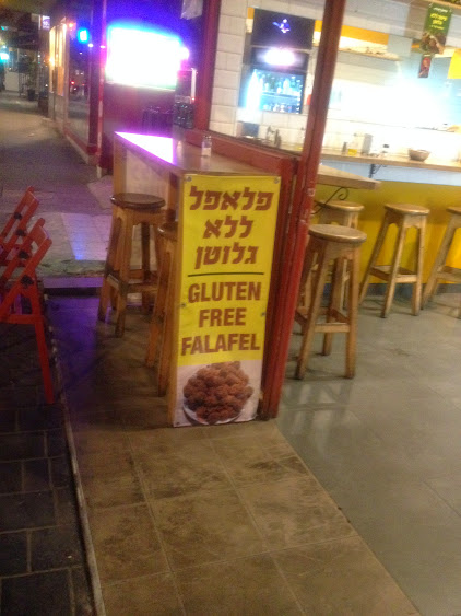
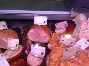 The seventh image of some ham that is for sale at a grocery on Hertzl street quite near Beth's apartment (this is the only store I found that had ham for sale).
The word for ham (Hatzarim - which is plural for pig) is shown in Hebrew but not English. This is perhaps because the customers for ham are mainly Russians and Arab Christians who don't know English well. Note also, that there are many types of ham for sale there.
The seventh image of some ham that is for sale at a grocery on Hertzl street quite near Beth's apartment (this is the only store I found that had ham for sale).
The word for ham (Hatzarim - which is plural for pig) is shown in Hebrew but not English. This is perhaps because the customers for ham are mainly Russians and Arab Christians who don't know English well. Note also, that there are many types of ham for sale there.
I took an intercity bus from Bnai Brak to Jerusalem (to see the Western Wall) a few days before we left. Ann was hoping to go but we decided her foot wasn't in good enough condition.
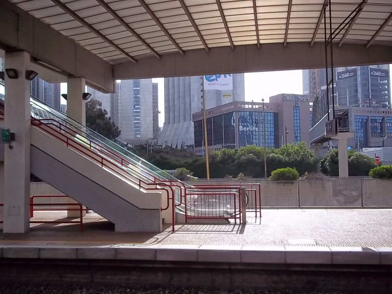
 The first image is of a large tunnel being built which will carry the high speed rail line, currently it is scheduled for completion in 2017. The expectation is that using this line, you will be able to get from Downtown Tel Aviv to Jerusalem in 34 minutes and from Ben Gurion airport to Jerusalem in 28 minutes (the Bnai Brak to Jerusalem bus took about 90 minutes with about a dozen different stops).
 The next four images are of the intra Jerusalem area light rail line (first image, from the System web site, is the map of the system). I could have taken this line from the central bus station in Jerusalem to the old city, but the stop is at the Damascus Gate. It isn't too far from the Western Wall (my destination) but it is confusing to walk through the Old City and I have several times gotten turned around trying to do this.
 Speaking of the Damascus Gate, the next image is from near there and shows the first passenger carrying light rail train in 2011 (image from the web).
The final two images show different perspectives of the Chords bridge (a.k.a., the Bridge of Strings, the Jerusalem Bridge of Strings, the Gesher HaMeitarim).
The first image of the bridge was apparently taken from the rail line itself (and from the internet).
 The bridge is about 1.5 miles (and 5 passenger stops) NW of the border of the old city. The individual steel cables (there are 66 of them) holding the deck are about 500' long and the bridge itself (cables, superstructure, substructure and deck) is about 1500' long and weigh about 4500 tons. This sounds like a lot but the just the cables alone which hold the deck of the east bay part of the Oakland Bay Bridge (also a one tower cable stayed bridge) weigh about that amount (total weight of that bridge, counting structure, connectors and deck, is probably more than 100,000 tons).
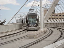
 The next image shows the bridge as seen from street level (taken by me). As one can tell, the bridge is a one tower cable stayed bridge. What is even more distinctive (cable stayed bridges are distinctive themselves), is that the tower leans and has two segments at different angles. This was done partly for aesthetics but also because the bridge has a curve and if the there were no leaning cable stay tower, I think it would have required a second tower (short bridges like this with curves in them are also pretty rare).

 The seder was quite a long one. We didn't get to the main course until after midnight and got to the afikomen a few minutes before 1:00am. As it turned out, Ann hurt her foot coming home from the seder. The image shows the foot a week or so later after it had been injured again. Ultimately this restricted our activities somewhat and Ann saw a doctor and got an x-ray (no fracture) in Tel Aviv on April 12.


.JPG)